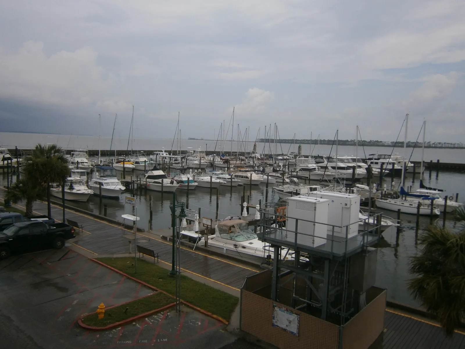
Point Cadet is the eastern tip of the Biloxi peninsula, a local historic district in ZIP 39530 served by Gorenflo Elementary and Biloxi High.
Last checked Oct. 16, 2026. Sources: the City of Biloxi’s 2009 comprehensive plan, East Biloxi chapter (PDF), the city’s parks page, the Biloxi Public School District’s attendance zones map (PDF), the Mississippi Department of Education’s report card, Zillow Research, the Coast Transit Authority and OpenStreetMap.
Point Cadet is the far eastern end of the Biloxi peninsula, where the city’s seafood industry grew up along Biloxi Bay. The City of Biloxi’s comprehensive plan, adopted in December 2009, names Point Cadet as one of the five local historic overlay districts in East Biloxi, and lists Point Cadet among the water features it calls “key to sustaining local identity, heritage, economy, and environmental health.”
What this means for you
- Schools: the Biloxi Public School District’s Gorenflo Elementary zone, then Biloxi High School, rated B on the state’s 2025-26 report card.
- Home value: $159,759 in ZIP code 39530 in September 2026, according to the Zillow Home Value Index.
- Nearest interstate exit: I-110 exit 1A/1B at U.S. 90, about 2 miles west.
Part of our Biloxi neighborhoods guide.
Where it is
Point Cadet sits east of downtown at the end of the peninsula, with Biloxi Bay to the north and east and the Mississippi Sound to the south. U.S. 90, Beach Boulevard, runs along its southern shore and turns north onto the Biloxi Bay Bridge to Ocean Springs. The plan’s historic resources map draws the Point Cadet district at the tip, east of the East Central district. It is in ZIP code 39530 and inside the plan’s East Biloxi planning area.
The plan says land along East Biloxi’s waterfront is used for casinos and hotels and for the industrial and commercial seafood trade, with mainly single-family homes in the interior of the peninsula. It also describes a museum district growing along Beach Boulevard east of downtown, including the Ohr-O’Keefe Museum of Art and the Biloxi Maritime and Seafood Industry Museum. Deer Island, a coastal preserve, lies just offshore.
Flood risk
The plan says most of East Biloxi lies in the 100-year floodplain and much of it sits seven feet or more below the base flood elevation on FEMA’s revised maps. It cites Gulf Coast Community Design Studio research that more than 65% of buildings destroyed or demolished after Hurricane Katrina stood on land less than 10 feet above sea level. Check a lot on FEMA’s flood map and read our building permits and zoning guide and hurricane prep guide.
Schools
The Biloxi Public School District’s attendance zones map, last revised in 2011 and linked from the district’s zones page, puts all of Point Cadet in the Gorenflo Elementary zone. Grades are from the state’s 2025-26 report card:
| School | Grades | State grade, 2025-26 |
|---|---|---|
| Nichols Elementary, 590 Division St. | Pre-K and K | B |
| Gorenflo Elementary, 771 Elder St. | 1-4 | B |
| Biloxi Upper Elementary, 1424 Father Ryan Ave. | 5-6 | B |
| Biloxi Junior High, 1921 Tribe Drive | 7-8 | A |
| Biloxi High School, 1845 Tribe Drive | 9-12 | B |
Grade spans are from the federal NCES school directory. The state says 2025-26 grades used the higher of the 2025-26 or 2024-25 English results because of a writing field test. More in our schools guide.
Home values
Zillow does not publish a figure for Point Cadet. Its index for ZIP code 39530, which covers the eastern peninsula, was $159,759 in September 2026, up 0.79% from $158,506 in September 2025, according to the Zillow Home Value Index. The city of Biloxi’s figure was $241,021. The index is a modeled typical value for homes in the middle of the market, not a sale price. See our home prices guide.
Parks and trails
From the city’s parks page and OpenStreetMap:
- Point Cadet Plaza and Splash Pad, 120 Cadet St., near Biloxi Bay: splash pad, playground, pavilion and restrooms. The splash pad and playground are open 9 a.m. to 8 p.m. in warmer months.
- Clay Point Park and D’Anella Park, both city parks a short way west, inside East Biloxi
- The Biloxi Bay Bridge path: the plan says the bridge was built with a 10-foot walking and biking path, which it calls heavily used
More in parks and trails and walking and biking trails.
Getting around
- U.S. 90: runs west along the beach to downtown and east over the Biloxi Bay Bridge to Ocean Springs.
- I-110: exit 1A/1B at U.S. 90 is about 2 miles west, per OpenStreetMap.
- Downtown Biloxi: about 2 miles by road. Gulfport-Biloxi International Airport: about 16 miles. Both are distances measured on the OpenStreetMap road network, not drive times.
- Buses: the Coast Transit Authority’s Casino Hopper (Route 2) serves the casinos on U.S. 90 and Bayview Avenue every 25 minutes, seven days a week; the Beachcomber (Route 1) runs along Beach Boulevard; and Route 7 goes to downtown Ocean Springs.
Groceries and everyday stores
From OpenStreetMap:
- Lee’s Supermarket, 913 Division St., about 2 miles west
OpenStreetMap lists no supermarket or pharmacy on Point Cadet itself.
Frequently asked questions
Where is Point Cadet in Biloxi?
Point Cadet is the eastern tip of the Biloxi peninsula, east of downtown, where Biloxi Bay meets the Mississippi Sound. The city’s comprehensive plan names it as one of five local historic overlay districts in East Biloxi.
What schools serve Point Cadet?
Point Cadet is in the Biloxi Public School District’s Gorenflo Elementary zone, then Biloxi Upper Elementary, Biloxi Junior High and Biloxi High School. Biloxi High earned a B on the state’s 2025-26 report card.
What is the typical home value in Point Cadet?
Zillow does not publish a figure for Point Cadet. Its index for ZIP code 39530 was $159,759 in September 2026, up 0.79% in a year. It is a modeled typical value, not a sale price.
Is there a park at Point Cadet?
Yes. Point Cadet Plaza and Splash Pad, 120 Cadet St., has a splash pad, playground, pavilion and restrooms; the splash pad is open 9 a.m. to 8 p.m. in warmer months.
Have your say